


Rwetyepme
Climbing Mount Sonder, and the Larapinta Trail

Originally published in Adventure Travel magazine, January 2004. Reproduced here exactly as written; and, as far as I remember, exactly as published.
‘A whole lot of country, and not a lot in it,’said Charlie, almost to himself.
It could have been a pat phrase, but it didn’t sound like it, and it sure as hell rang true. An abrupt slash of a gully almost breached the ridge we had been climbing. Its steep fall pulled the gaze down and over a level expanse of open bush. It was hard to judge distances in the clear air, especially with no roads or buildings for scale. Somewhere in the middle distance, a thin cloud of dust was unwinding; through binoculars we could see it was being raised by a string of cattle, but the station to which they belonged was somewhere beyond the next ridge, thirty or forty kilometres away. This was the Australia I’d read about as a kid, the land of kangaroos, boomerangs, and farms the size of Belgium.
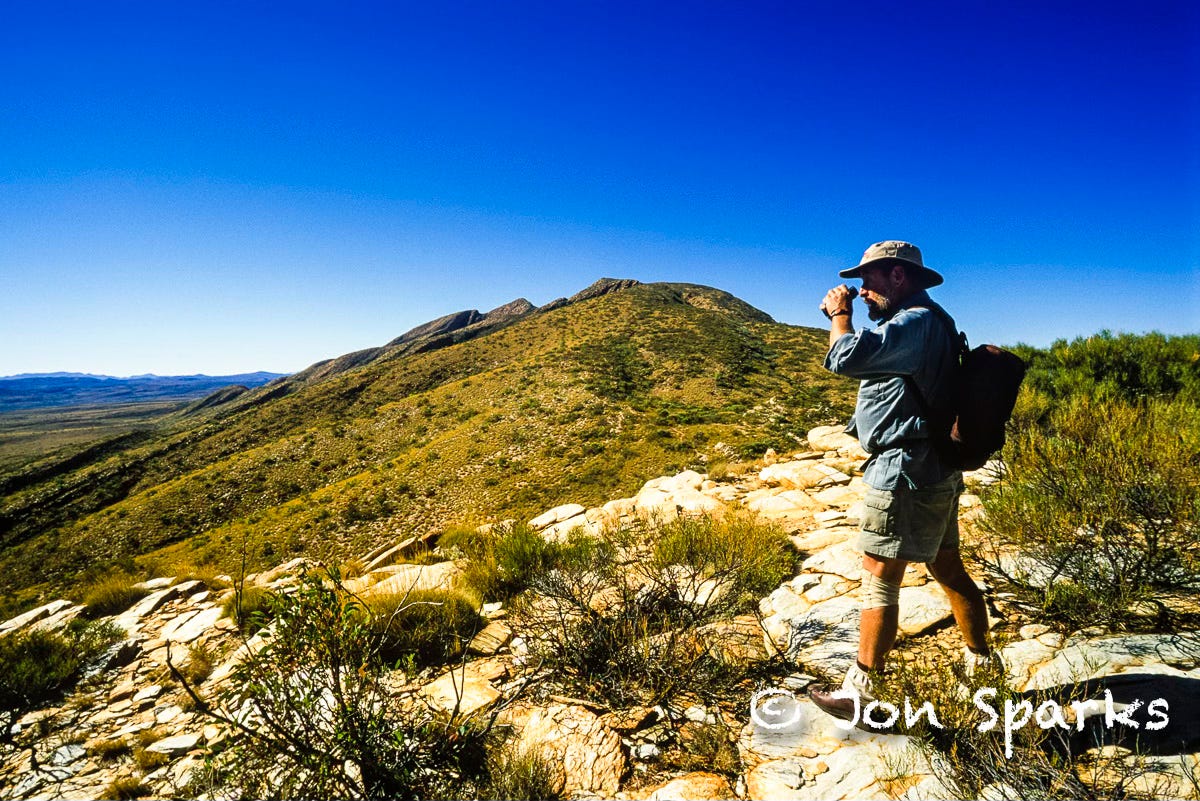
We were well on the way up the west ridge of Mount Sonder—Rwetyepme to the indigenous Arrernte people. Thin soil, sparse vegetation—each scrubby mallee or mulga a distinct individual—bands of tan and ochre rock, a tenuous scuff of a path. Weirdest of all were the termite mounds, like displaced stalagmites: these were only two or three feet high, nothing like the five-metre monstrosities of the Top End, but I still found them oddly fascinating, and faintly unsettling. Constructed by thousands, maybe millions, of blind, mindless workers, they always made me feel I was in the presence of aliens.
For every ‘alien’ moment there was another when things seemed just as I’d expected. Those childhood stories, plus Skippy, ‘Crocodile’ Dundee and innumerable photographs, had built the landscape in my imagination. But imagination can only take you so far: you still have to go. Imagination could never match what I’d seen this morning. A three-second glimpse of two Red Kangaroos, mother and youngster, skimming across the flats below Sonder in the early light, was the loveliest sight of my entire Australian trip. I was nowhere near ready with the camera, but the lens of memory fixed the image.
If it all looked half-familiar at times, other senses told a different story. The scents of eucalyptus and acacia. The dry rasp of the air, and the precipitous drop in temperature as night fell. The distant howling of dingoes as I lay huddled in my swag. And when I did stick my head out of the swag, the Milky Way was brighter than I had ever seen it.
I continued musing as we climbed on, skirting a hollow in the hill just before the top. Maybe I just wasn’t looking at the landscape in the right way. Even with a great guide like Charlie Carter on hand, I certainly wasn’t seeing it as the indigenous people would. To the Western Arrernte, who inhabited this part of the Red Centre for millennia before the whites came, the land was everything. Everyone knows, I suppose, how Aboriginal peoples across Australia were persuaded to ‘sell’ their land because the concept of land-ownership was alien to them. It would be closer to the truth to say that they belonged to the land, rather than the other way around.

Later, Charlie told me that the Arrernte, like most Aboriginal people, did not make maps, not even ‘mud-maps’ . Instead, they told stories. More like a guidebook than a map, I suppose, but their songs and stories were many-layered and served many purposes. To see them simply as creation myths is to miss the point, and to dismiss them as mere fairy tales is simply insulting. Their stories may sound like myths to us, but they embody a vast amount of solid practical knowledge. ‘Culture’ was not an optional extra for easy times. Culture was survival.
What’s more—and this is what really struck me—the stories were told and retold as the people walked across the land. In other words, the knowledge of the land was transmitted in the land. Again, it is a little like reading a guidebook. You can sit at home and browse through it, but it only comes alive when you actually use it. Though the Arrernte stories were like guidebooks that told, not just where to walk, but how to live.
Lost in my thoughts, I realised belatedly that we were nearly at the south summit. Bare rock poking through, a sudden falling away ahead of us: the east face all red rock, steep blocky ridges and shadowy gullies. To the north the main ridge curled down, then rose again to the main summit. The rise looked easy, but part of the descending ridge was hidden. Charlie confirmed that it was steep, exposed, would demand ropes.
In any case, we were strongly requested not to venture beyond the south top. The whole mountain is sacred to the Arrernte and it is important that visitors stick to the agreed route. Maybe the main top was a few metres higher, but it would not add much to the view. It blocked a little of our panorama to the north, but hid nothing that we hadn’t already seen from other angles.
Mount Sonder is 1380m high, making it the fifth highest peak in Australia west of the Great Dividing Range. If that seems a rather contrived distinction, remember that about 95 percent of Australia is west of the Great Dividing Range: a truly vast area, big enough to swallow the whole of Western Europe. We had seen just a sliver of it, but one of the most rugged parts.
The West Macdonnell Ranges, stretching west from Alice Springs, are ancient, scarred ridges, the red ribs of the Red Centre. The Larapinta Trail traverses the ranges, sometimes on the high ridges, sometimes in the intervening valleys, occasionally cutting through them by dramatic gorges. It reaches its most westerly point by skirting below Mount Sonder, but the ascent is a fitting culmination to the trip.
Looking back east, I could see much of the territory we had traversed in the previous two days. The high ridge of Count’s Point stood out clearly, crowning one of the parallel quartzite ridges which characterise so much of the West Macs. Stand-alone peaks like Sonder are rare. But what this view could not show was the way those ridges are slashed through at intervals by deep gorges, carved by pre-existing rivers as the land was uplifted and the ranges exposed by erosion.
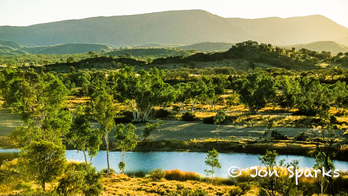
Serpentine Gorge, not far east of Count’s Point, was a perfect example. Winding down from the ridge, the shadowy slit had begun to open up ahead, and then we were in its sudden shade. Red rock walls reared above still pools. The rivers of the Red Centre run only occasionally, but water can usually be found in the cool depths of these gorges.
If the view from Sonder summed up what we had seen, it also brought home to me how little that was. We hadn’t even done most of the Larapinta Trail, and that is only one brief thread in a vast space. In a few days all we could hope to do was get a taste of it.
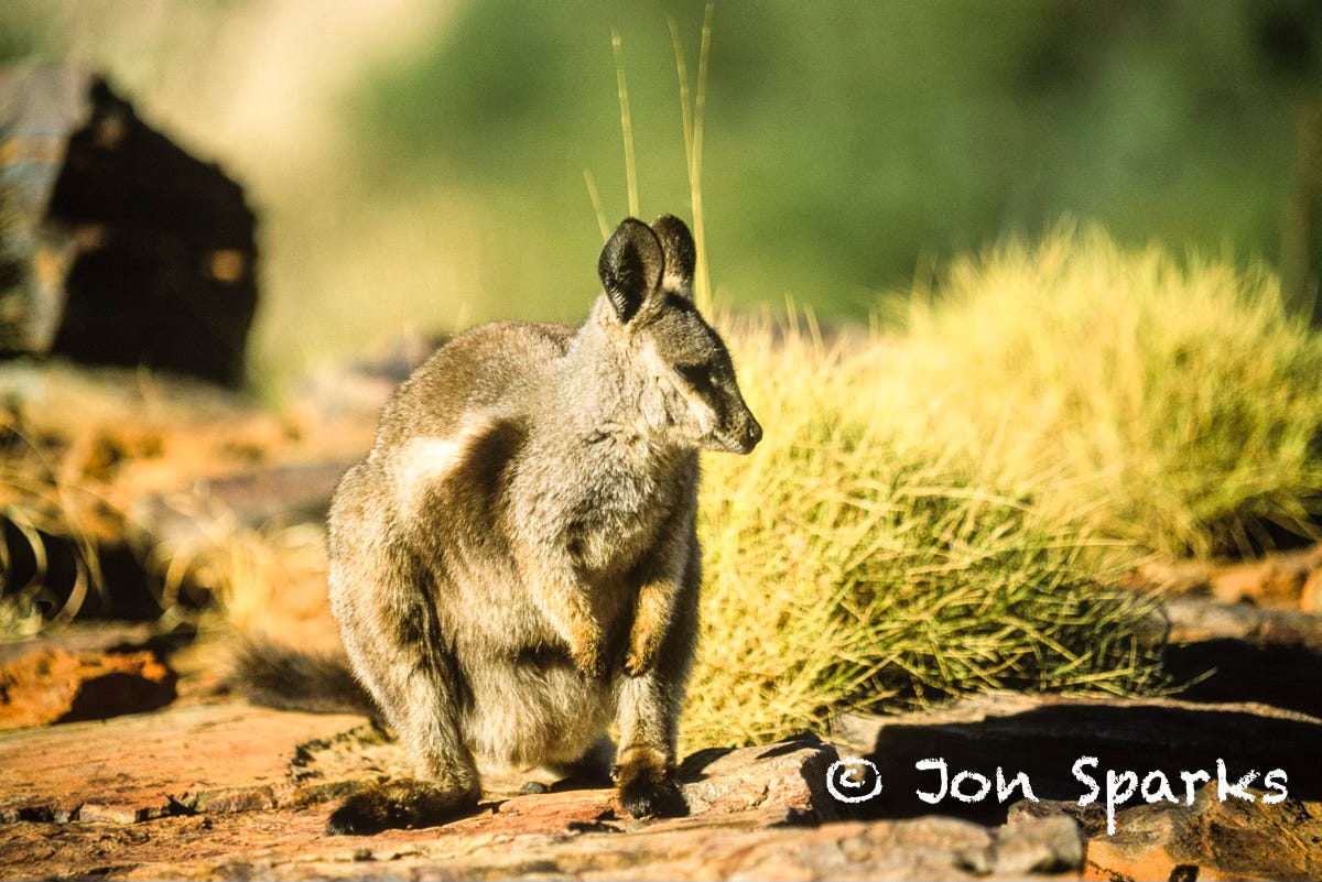
The taste seemed much clearer a day later. Ironically, the walk which seemed to bring it all together wasn’t even part of the official Trail route. Seeking a shorter outing before the return to Alice, we took the Ormiston Pound Walk. The Pound is a flat-floored bowl, almost completely hemmed in by hills—an ideal place to ‘pound’ the cattle. The Larapinta Trail skirts just south of it and we started by reversing a short section of the route. We paused a while to watch, and photograph, a group of wallabies at the lip of a crag: they were aware of us, but quite unconcerned, probably more interested in sunning themselves after a chilly night.
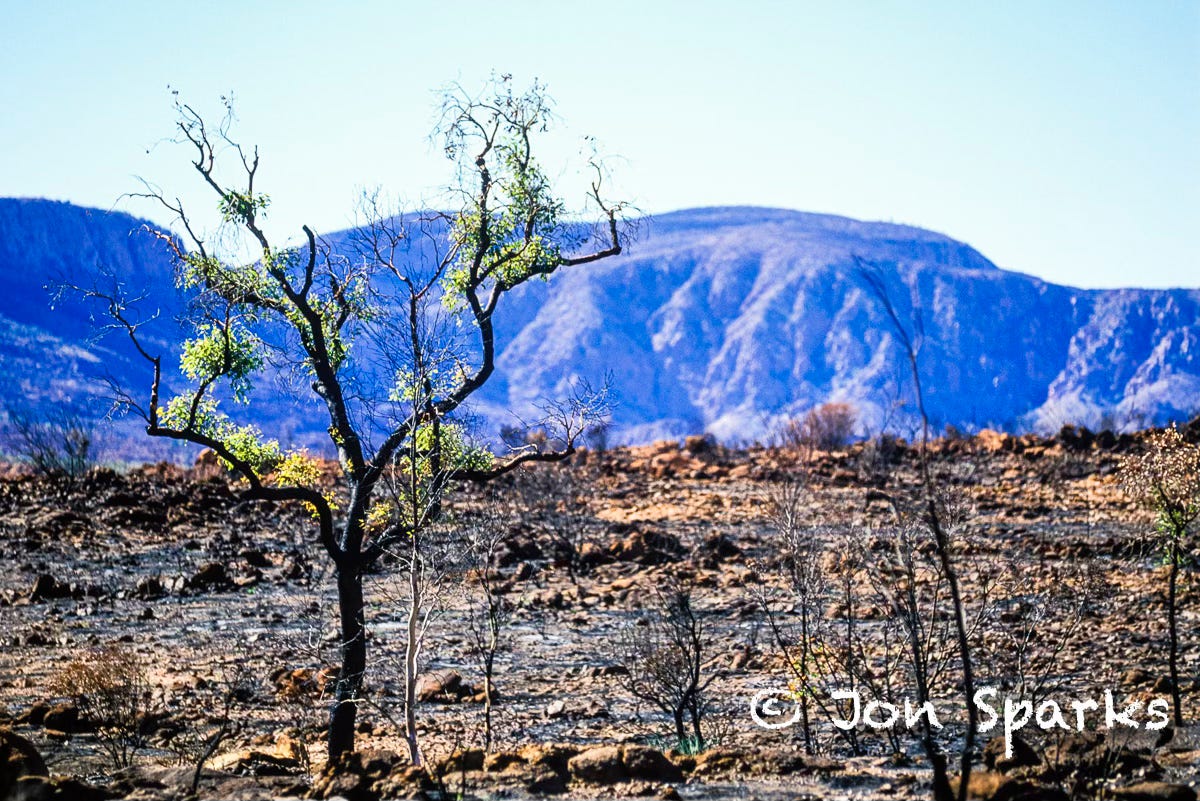
We moved on, up to a viewpoint on the southern rim of the Pound. Though actually formed by faulting and water erosion, the great sunken bowl looks more like a crater. Adding to the sense that cataclysmic forces had been at work, most of its floor still showed the effects of a recent bush fire.
We had seen burned areas several times over the preceding days, yet none had the same impact. Blackened trees and scorched rocks surrounded us: everything was red, black or brown, with scattered frills of returning foliage adding a few tentative touches of green. Now this, I thought, this was nothing like home.
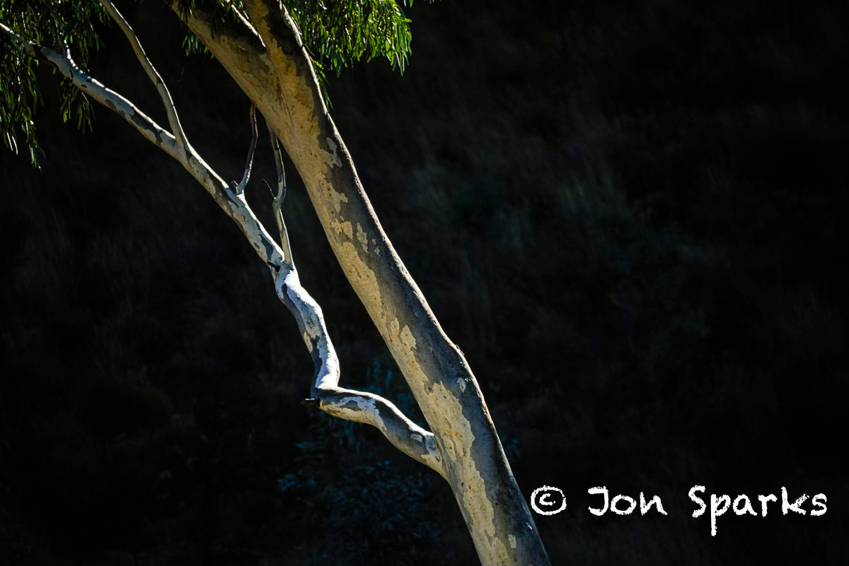
Crossing the course of Ormiston Creek was like crossing a frontier. Though its bed was mostly dry, the Creek still represented a gap the fire had been unable to cross. The palette shifted: the green foliage and silvery trunks of Ghost Gums stood out against the red rocks.
The walls ahead grew higher, funnelling us into Ormiston Gorge; over 200m deep, it sees little direct sun. The temperature dropped sharply. And yet the north wall glowed intensely orange. Bounce sunlight off red rocks onto more red rocks and this is the result: easily explained, yet hard to comprehend. The red seems unreal, almost Martian. I wondered what the Arrernte stories said about it.
Near the exit from the gorge is a deep, permanent waterhole, complete with fish. Almost a dozen small herons lurked patiently on various boulders and ledges, waiting for dinner. More wallabies skittered across the rocks, leaping gaps with casual grace.
It was only five minutes from the waterhole back to the car-park: from one of the most magical stretches of the entire trip, back to mundane concerns like who got the front seat.
If you’ve enjoyed this piece and you’d like to show appreciation without becoming a paid subscriber, you could always…
I should have added in the intro that this story was the second article to result from the trip to Oz. The other, covering the sea voyage from Cairns to Nhulunbuy—and the reason I left the yacht here rather than continuing to Darwin was needing to be sure I got to Alice Springs in time to meet my commitment to the Larapinta trip.
You can read about that sea cruise too: https://open.substack.com/pub/theshatteredmoon/p/a-life-on-the-ocean-wave